Muliwai Trail, Waimanu Campground reopens, 3/19/07
The Muliwai Trail on the Big Island, closed since the Oct. 15 earthquake, is reopening today following completion of maintenance work on the 18-mile trail and the Waimanu campground.
The Department of Land and Natural Resources announced the reopening in a news release.
Camping permits are new being issued for Waimanu Valley Campground at the Hilo DLNR Forestry and Wildlife office at (808) 974-4221.
“This popular, but remote, trail was closed following the earthquake for public safety until we could conduct on-the-ground inspections and trail maintenance by our trail program staff,” said Peter Young, DLNR chairman. “It is now ready to be enjoyed once again by the public.
“However, some trail sections leading to the back of Waimanu Valley will be signed and remain closed due to persistent danger of landslides and falling rocks from above.”
“We have removed the fallen tree and several others in the campground that were hazardous. Our program staff also carried out general maintenance at Waimanu campground, including washing, painting and re-roofing the composting toilets, and removing ten 33-gallon size bags of trash by sling loaded helicopter.”
The trail zigzags up the western wall of Waipi’o Valley on the Big Island, climbing approximately 1,200 feet to the plateau. Read article.
Hamakua Ditch Update, 2/25/07
Kulani inmates recently finished two months of work clearing damage to the ditch caused by the Oct. 15 earthquakes. The water from the upper ditch is flowing again to area farms and ranches.
The normal flow of up to 10 million gallons a day dropped to zero following the quakes, said Ernest Afonso, manager of the Waimea Irrigation System which includes the 15-mile upper ditch serving 118 customers. He also manages the 24-mile Lower Hamakua Ditch, which usually serves about 250 but is still dry pending further repairs.
Canonio was in a crew of 10 inmates, but a total of 28 have worked on the two ditches, said Kulani work supervisor Leonard De Cambra.
They were just part of efforts to restore water there. An average of 25 National Guard personnel a day also worked there as well as individual volunteers. Costs were about $585,000, said Civil Defense spokesman Ray Lovell. Read article.
Kealakekua Bay Update, 1/15/07
Department of Land and Natural Resources has eased the restricted area for boaters. The exclusion zone is marked by orange buoys. boaters and swimmers are to get no closer to the cliff face than these buoys. Additionally, the shore adjacent to and west of Captain Cook Monument is now accessible. You can now beach your kayak on shore and visitors can visit the monument from the bay or via the foot path.
Excerpt from the West Hawaii Today Newspaper:
“Officials have opened a portion of the Kaawaloa flats area, allowing kayaks to land on the ocean side of the Captain Cook Monument within the Kealakekua Bay State Historical Park. The trail from the top of Napoopoo Road to the bay is also open. However, hikers must stay away from the unstable area at Pali Kapu o Keoua.”
Kealakekua Bay Update, 12/17/06
We just visited Kealakekua Bay and Kayaked to the Captain Cook Monument. At this time, you can kayak across the bay and snorkel in the coves at Captain Cook Monument. However, you still need to stay away from the high cliffs to the east - authorities have placed bright orange buoys in the water here so that you can avoid these areas. Additionally, you are not allowed to walk on the shore, beach your kayak, or in any way leave the waters of the bay. However, this should not prevent you from still enjoying your time kayaking and snorkeling this bay. The best thing to do is simply snorkel next to your kayak while holding onto the rope tied to your kayak.
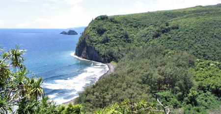
Pololu Valley Trail Reopens, 11/21/06
Update 11/21/06 - State officials have reopened the Pololu Trail in North Kohala, part of the Old Government Road that leads to an area called Awini where Kamehameha I was hidden from enemies in his early childhood.
The trail, down a 420-foot cliff face, had been closed since the magnitude-6.7 and 6.0 earthquakes on Oct. 15. Following the quakes, sections of the trail were subject to continuing rockfalls, said Department of Land and Natural Resources Director Peter Young.
Due to the earthquake, there were sections of trail that were subject to continuing rockfall, that have now been scaled back and rebuilt in the areas that were unstable.
Also, an approximately 20 foot section of the trail surface along a switchback was re-built to accommodate access. The trail surface had narrowed due to slippage.
Various sections of the trail, which runs in a steep zigzag down the vegetated cliff face, have been rebuilt - news release.
Kealakekua Bay Restrictions Eased, 11/21/06
Far to the south at Kealakekua Bay, the department eased the restricted area for boaters. Following the partial collapse of the cliff face there during the earthquakes, boats had been required to stay 300 feet from the cliff, but that was reduced last week to 100 feet - read article.
Earthquake Damage Estimates, 11/11/06
According to consultant reports to the DLNR:
» Hulihee Palace, built in 1838 and renovated by King Kalakaua in 1886, has extensive damage, though not to the extent of earlier concerns that it is not structurally sound.
» The Kailua-Kona’s wharf has extensive cracking in its concrete deck slab, pile caps, stairways, walls and boat ramps. If the cracks are not fixed, corrosion will eventually destroy the structure.
» A monument marking King Kamehameha I’s birthplace in Kohala has damage to rock walls.
» The rock walls of the 600-year-old fishing village at Lapakahi State Historical Park are down in numerous places.
» Makena State Park on Maui needs at least $100,000 worth of rock-scaling work to make its Big Beach safe — and could require much more if multiple slide sources overhanging the park’s Black Sand Beach are addressed.
» Hapuna Beach State Recreation Area has damage to rock veneers, wood and cement components of restrooms and rest shelters that if not fixed will cause further deterioration.
State park damage estimates are at: www.hawaii.gov/dlnr/reports/earthquake/.
Earthquakes Strike Big Island of Hawaii, 10/15/06
Estimates of damage caused by the biggest earthquake that struck the U.S. state of Hawaii in 23 years surpassed 100 million U.S. dollars by the end of last week, the USA Today newspaper reported Monday.
The magnitude-6.7 quake hit Hawaii’s Big Island on Oct. 15, and was followed minutes later by another measuring 6.0 on the Richter scale and more than 100 aftershocks, the U.S. Geological Survey Hawaiian Volcano Observatory said.
Initial estimates of damage was put at less than 100 million dollars, but the figures soared as damage to hotels, roads, a harbor and homes was discovered.
More than 1,130 houses on the island were damaged and 29 more were uninhabitable, Ed Teixeira, of the state Civil Defense office,was quoted as saying.
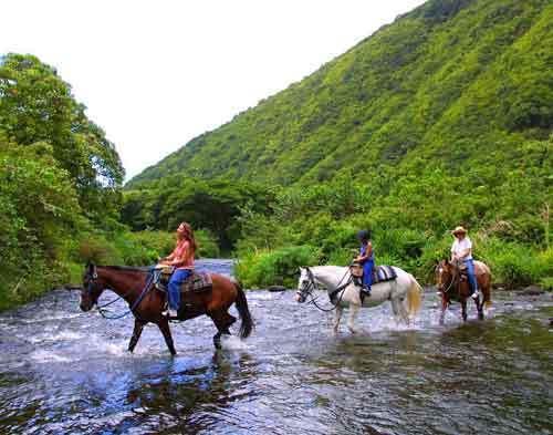
Big Island Hiking Activities
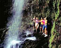 The magic of the Hawaiian Islands will unfold before you as your Interpretative Naturalist Guide teaches you the history and ecology of this beautiful land. Imagine walking along a cliff-side trail 1,000 feet above the valley floor. Breathtaking views will stretch before you.
Pololu Valley Kohala Wai Adventure
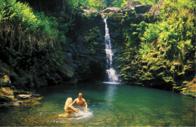
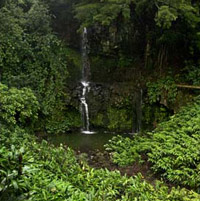 Explore the remote Pololu Valley area on the northern tip of the Big Island aboard a rugged off-road Pinzgauer 6×6 vehicle. Witness the life-giving and land-sculpting power of water, as you ramble through a changing landscape of rushing streams, towering ocean cliffs and cascading waterfalls. You’ll even have time to kick off your shoes and take a dip in a cool mountain pool!