


Kona Hawaii

Hapuna Beach is probably the most famous beach on the Big Island, and regularly voted one of the prettiest beaches in the world. In Big Island standards, it's also one of the largest beaches on the island. The shore has a sandy bottom, and the sand shelf extends a good ways out. The … [Read More...]
Hawaii Volcano

Where Can I View the Active Lava Flow? There are many great opportunities to view the dramatic Kilauea Volcano's active lava flow. Depending on the dynamics of the lava flow, you may be able to get close to a surface lava flow, watch the explosive ocean entry, or even see glowing cracks and smoke … [Read More...]
Beach Guide
Hapuna Beach is probably the most famous beach on the Big Island, and regularly voted one of the prettiest beaches in the world. In Big Island standards, it's also one of the largest beaches on the island. The shore has a sandy bottom, and the sand shelf extends a good ways out. The … [Read More...]
Captain Cook

Captain Cook Discovers Hawaii Captain James Cook and his ships, the Resolution and Discovery, entered the sheltered waters of Kealakekua Bay (Pathway of the God) on the morning of Jan 17, 1779, during the height of a local religious festival. Thinking Cook was a returning God, the Hawaiians … [Read More...]
Travel Planning Articles

Where to Stay on the Big Island
One of the most popular questions we receive from our site visitors is "Where Should I Stay on the Big Island?" The answer to this question... "well, it depends!" … [Read More...]

Overview of the Big Island
The Big Island has earned its name due to the fact that it is larger than the land area of all the other Hawaiian Islands put together. If you are familiar with some of the other … [Read More...]

Vacation for Families
The Big Island of Hawaii is a wonderful place for vacationing families. There are a wide variety of activities and attractions for the whole family and many are unforgettable for … [Read More...]
Big Island Tours & Activities
The best way to enjoy the wonderful weather, scenery, and beautiful waters of Kona is to take part in some of the many tours and activities. Sign up ahead of time through … [Read More...]

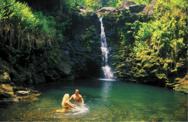 Hike
with an expert guide in Hawai'i Volcanoes National Park, in the rain
forests, deep in remote valleys, and explore hidden waterfalls
Hike
with an expert guide in Hawai'i Volcanoes National Park, in the rain
forests, deep in remote valleys, and explore hidden waterfalls
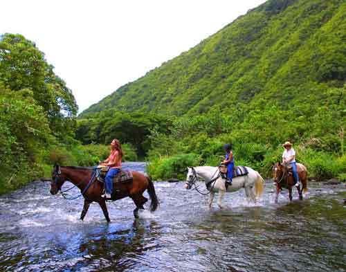 Enjoy
a picturesque Hawaiian horseback ride through the Valley of the
Kings, a lush tropical paradise of jungle trails, waterfalls, and spiritual sites.
Enjoy
a picturesque Hawaiian horseback ride through the Valley of the
Kings, a lush tropical paradise of jungle trails, waterfalls, and spiritual sites.
